Version History
Here you can find the changelog of SityTrail hiking trail GPS since it was posted on our website on 2015-04-25.
The latest version is and it was updated on soft112.com on 22 April, 2024.
See below the changes in each version:
version N/A
posted on 2024-01-10
- Compliance with new EU GDPR regulations
- Minor bug fixes
version N/A
posted on 2024-01-10
- Support for new IGN France geoplatform
- Minor bug fixes
version N/A
posted on 2023-12-11
- Improved user experience for signing in, by entering a code
- Better support for custom fonts and font sizes
- Black background for all screens
- Improved startup time and splash screen
- Support for rotary input for scrolling in settings screens
version N/A
posted on 2023-10-09
- Improved user experience for signing in, by entering a code
- Better support for custom fonts and font sizes
- Black background for all screens
- Improved startup time and splash screen
version N/A
posted on 2023-09-18
- Improved user experience for signing in, by entering a code
- Better support for custom fonts and font sizes
version N/A
posted on 2023-09-05
- It is now possible to change the starting point of a loop trail by pressing and holding at the location where you wish to place the start and then tapping on the loop icon.
- When you start tracking a loop trail and you are not at the starting point, the app offers you the option to change the starting point.
- Fixed a major bug that prevented the app from launching when the app's notifications were disabled.
version N/A
posted on 2023-08-24
Wear OS changes / improvements :
- Interface is now in dark mode
- Time is now displayed above all screens
- Support for ambient ("always on") screen mode
- Support for Wear OS 4
- Bug fixes and improvements
version N/A
posted on 2023-08-11
- Native compatibility with Android 13
- Bug fix on Wear OS : Recorder counter values were not refreshed automatically on the watch
- Libraries updates
- Minor improvements and bug fixes
version N/A
posted on 2023-06-12
New beacon feature allows for real-time sharing of your location with friends and family via a simple link.
Enable this feature in the "LIVE" tab at the bottom of the map. You have the option to select the frequency of position updates and the duration of the beacon's activation.
version N/A
posted on 2023-05-17
- NEW: 3D visualization of the trail's aerial photos (recommended) or topographic maps
Accessible from the trail's information page
Demo here: https://www.youtube.com/watch?v=YRNJxOEdX64
- Fixed an issue with the transmission of the logged-in user's account to the Wear OS watch
- Bug fixes and various improvements
version N/A
posted on 2023-05-08
- New easy access to account management
- Fixed a bug preventing users from logging in to their account in some cases when both SityTrail and SityTrail World apps are installed
- Improved slopes map
- Minor bugfixes
version N/A
posted on 2023-04-12
- Support for new IGN France server certificates on Android 9 and lower versions
- Improved integration of subscriptions for paid trails communities
- Enhanced sharing of trails, lists, communities, and users via a compact URL and QR code
- Ability to choose not to automatically recalculate the duration and difficulty of a hike when editing the trail
- Bug fixes
version N/A
posted on 2023-03-29
- Better notifications support.
- New Notification Center available in the left menu.
version N/A
posted on 2022-03-28
- Quick actions on long press on the app icon.
- Links are now clickable in the trail description.
- Several improvements and bug fixes.
version N/A
posted on 2021-12-21
- Loop trails can easily be identified in the interface
- Minor bug fixes and improvements
version N/A
posted on 2021-12-07
- Optimizations for Android 11.
- Guidance by notifications: this feature is mainly useful with smartwatches: Garmin, Suunto, Xiaomi Band/Watch, Huawei, old Samsung Tizen, ...
These notifications include direction changes with configurable sounds and out of trail alerts.
This mode can advantageously be used if you don't want to be bothered by the classical voice guidance (default mode).
- Enable/disable automatic triggering of points of interest.
- Several bug fixes and improvements.
version N/A
posted on 2021-10-25
- Battery usage optimization when recording a trail in the background.
- Fix for background trails recording and following problems with Android 11 devices.
- Fixed : upload of trails blocked in some cases.
- Fixes in angles calculation for trails following.
- Fixed : invalid status of the user in the community.
- Minor user interface fixes for small Wear OS watches.
- Minor bug fixes.
version N/A
posted on 2021-09-27
- Battery usage optimization when recording a trail in the background.
- Fix for background trails recording and following problems with Android 11 devices.
- Fixes in angles calculation for trails following.
- Fixed : invalid status of the user in the community.
- Minor user interface fixes for small Wear OS watches.
- Minor bug fixes.
version N/A
posted on 2021-09-20
- It is now possible to search for trails of the catalog on the map.
- Improvements in the filters / sorting UI selection screen.
- Bug fixed : there was no voice synthesis in some cases when a Wear OS watch was paired with the smartphone but not available.
- Minor bugfixes.
version N/A
posted on 2021-09-09
- Solved an issue with old opened trails that could not be opened anymore.
version N/A
posted on 2021-07-26
- Bug fixes.
- Connection to Google Fit temporarily disabled, it will be enabled again in the future but we need to do changes to conform to the new Google policies.
version N/A
posted on 2021-03-23
- Wear OS app improvements
- Minor bug fixes
version N/A
posted on 2020-12-03
- The permission to always use the location is not required anymore.
- Google libraries update
- Wear OS app improvements
version N/A
posted on 2020-11-05
- Bugfixes
version N/A
posted on 2020-10-19
- Adding support of Google Fit
- Bugfixes
NEW: Marked trails are now available in Premium World subscription:
- Discover GR hiking paths, European hiking routes, routes of Santiago de Compostela, ...
- You can also discover all cycling networks : Greenway network in France, Ravel in Belgium, European cycling routes, knot points networks in Flanders and Netherlands.
- And for winter, discover all ski slopes.
version N/A
posted on 2020-08-12
- Bugfixes.
- The trails of Pro communities can now be opened and followed without an account.
version N/A
posted on 2020-07-23
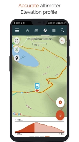
- Fixed a bug on elevation profile display
version N/A
posted on 2020-06-25
New feature available for holidays : SityTrip!
Choose a city and view Wikipedia points of interest around a place. Useful to get information about heritage, historical facts, street names, ...
For tourist cities, you can also get a lots of recommended activities that you can book in advance.
- Solved an issue with localization inside SityTrip community.
- Minor bugfixes.
version N/A
posted on 2020-06-17
New feature available for holidays : SityTrip!
Choose a city and view Wikipedia points of interest around a place. Useful to get information about heritage, historical facts, street names, ...
For tourist cities, you can also get a lots of recommended activities that you can book in advance.
version N/A
posted on 2020-05-28
- Optimisations for the main tabs of the app (Newsfeed / Discover / My Data). Some screens are displayed 60% faster !
- Fixed a crash on Android 4.4
- Minor bugfixes.
version N/A
posted on 2020-05-22
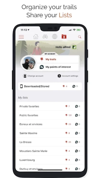
- Display trails and points of interest on a map from a list, a community or a user (or yourself).
- You can now create a list from the My Data screen.
- The app is now available for Wear OS smart-watches : keep an eye to your trail following and/or your recorder at any time.
- You can open your communities or communities you follow from the My data screen.
version N/A
posted on 2020-01-21
- Better support of Android 10
- The warning at startup is now only displayed when the terms of use or the privacy policy have changed
- Direct access to our shop from the main menu of the application
- The application detects when you cannot access your account anymore (password changed, ...) and asks you to log in again
- Several bug fixes and improvements
version N/A
posted on 2019-12-23
- "Contacts" permission not asked anymore on Android 7+ devices.
- Adding an option in settings to allow automatic counter pause when you don't move while recording.
version N/A
posted on 2019-12-17
- You can now purchase a subscription to the catalog of trails edited by "Les Sentiers de Grande Randonnée" in Wallonia (Belgium).
- Preview trails in 3D mode with link to Google Earth app.
- Share trails from the trail details.
- Share photos of trails from the photos viewer to Instagram. Add #sitytrail !
- Better support for Android 9.
- Bugfixes.
version N/A
posted on 2019-12-02
- Preview trails in 3D mode with link to Google Earth app.
- Share trails from the trail details.
- Share photos of trails from the photos viewer to Instagram. Add #sitytrail !
- Free testing week for Freemium only to discover all topographic maps and Premium fonctions of Sitytrail.
- Better support for Android 9.
- Bugfixes.
version N/A
posted on 2019-11-23
- Preview trails in 3D mode with link to Google Earth app.
- Share trails from the trail details.
- Free testing week for Freemium only to discover all topographic maps and Premium fonctions of Sitytrail.
- Better support for Android 9.
- Bugfixes.
version N/A
posted on 2019-10-08
- Create points of interest directly from the app.
- Display downloaded points of interests on the map.
- Bugfixes.
version N/A
posted on 2019-10-07
- Improvements in map download speed
- Solved several issues on map download
- Better informations about locations in trails, points of interests and long press on map
- Creation and modification date are not displayed in details, and creation date is displayed by default on all lists
- Bugfixes
version N/A
posted on 2016-09-12
- A Digital Terrain Model has been integrated in the application :,* Better downhill / uphill calculation.,* The elevation profile is now available for all trails.,* You can get the accurate elevation for a location on the map with a long press.,* In the counter, you can get the elevation of the ground for your current location.,Warning : You have to launch a new download of your maps to get elevation data.,- Faster location acquisition on the map,- Bug fixes and improvements
version 3.1.1
posted on 2011-04-01
Several fixes and updates